Why it's impossible to measure England's coastline

 Getty Images
A new hiking trail will soon allow travellers to walk around England's entire coast – but a strange paradox means no one knows exactly how long it is.
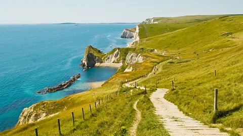
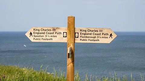
Last month, King Charles III inaugurated a new hiking path that will soon stretch around the entire coast of England. The project is roughly 80% complete, and when it fully opens later this year, the King Charles III England Coast Path will become the longest managed coastal walking path in the world.
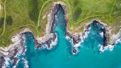
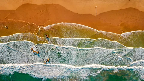
The 2,689-mile-long (4,327km) ramble connects the granite cliffs of Cornwall with the rolling sand dunes of Northumberland and East Sussex's iconic white chalk cliffs, allowing travellers to explore England's extensive shoreline step by step.
But while the length of the newly designed path is easily measurable, the coastline that it follows is not. England's coast is often measured as part of the UK's, but look up how long that is and you'll get wildly different answers from various reputable organisations. The CIA World Factbook lists the UK's coastline as 7,723 miles (12,429km), while The World Resources Institute measures it at 12,251 miles (19,716km) – a discrepancy of more than 4,500 miles (7,242km).
"The thing is, no one really knows exactly how long England's coastline is, or the United Kingdom's or most coastlines around the world, for that matter," said Victoria Braswell, a researcher and member of the Royal Geographical Society. "It's all in how you measure it."
 Getty Images
Search for a larger territory like the United States and this disparity grows even further, from 12,380 miles (19,924km), according to the CIA World Factbook; to 84,000 miles (135,185km), according to the US Army Corps of Engineers; to an astonishing 95,471 miles (153,646km), according to the National Oceanic and Atmospheric Administration (Noaa), the federal agency responsible for mapping the US's coastline.
One reason why these measurements vary so greatly, and why none is technically wrong, goes back to a curious discovery made by a British pacifist who was trying to understand war – and it's pitted nations against each other.
The coastline paradox
In 1921, a Quaker mathematician and physicist named Lewis Fry Richardson wondered whether nations with longer shared borders were more likely to go to war. During his investigations, he noticed something peculiar: Spain reported its border with Portugal as 987km (613 miles), while Portugal measured it as 1,214km (754 miles). Belgium and the Netherlands also had a 69km (43 mile) disparity, and countries across the continent had similar disagreements.
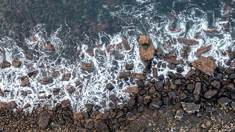
Since these measurements were vitally important for a nation's sovereignty, Richardson wondered why the differences were so widespread. At the time, most countries measured their borders and coastlines by examining a map and placing rulers of equal length along their boundaries, so that one end of the ruler was always touching the other. But since almost no borders or coastlines are perfectly straight, Richardson realised that the smaller the ruler, the more curves it captured – and the longer the total measurement became.
This phenomenon became known as the coastline paradox, and it applies to virtually all borders, boundaries and coastlines with especially jagged, twisting lines – like England's.
"Let me show you what this paradox looks like," said Danny Hyam, a senior geospatial consultant for the Ordnance Survey, Great Britain's national mapping agency.
"This is Britain's coastline at a scale of 1:1,000,000," he said, pulling up a broad, boxy border around the territory on his computer screen. "At that scale, it gives you a [coastline] measurement of 16,652km (10,347 miles). If I go down to 1:250,000, you start to see a bit more detail along the edges, islands appear that didn't before and that coastline is now 22,400km (13,919 miles). If we go to 1:50,000, jetties and more defined inlets appear, and our coast becomes 28,509km (17,715 miles) long. Then if I go to 1:2,500, the coastline becomes even more complicated, and it has now more than doubled in length."
Hyam added, "If I were to go down to 1:1, you'd be going around every barnacle, and suddenly our coastline would become longer, and longer and longer." As he explained, that is the paradox: the closer you look, the longer the coastline becomes.
 Getty Images
In fact, Richardson found that were you to examine a coastline in ever-smaller units – down to every grain of sand or even every atom – the length of a coastline would appear to approach infinity. So, paradoxically, you could have a defined territory surrounded by a seemingly infinite boundary.
Real-world disputes
Long before this paradox was fully understood, it was fuelling diplomatic tensions. In the late 19th Century, the British Empire and the US disagreed over where the border should divide British Columbia and Yukon from the Alaskan panhandle. One of the causes of this quarrel was the fact that each group was using a different sized ruler to measure the coastline, because an old treaty had declared, in highly vague terms, that it: "shall be formed by a line parallel to the winding of the coast".
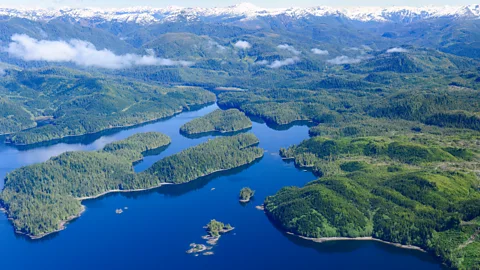
Alaska's complex, fjord-filled coastline winds a lot (so much so that according to Noaa, it's 9,000 miles (14,484km) longer than the equator). By using a larger ruler that cut across these fjords and inlets, Canada claimed better access to the Pacific Ocean. But by using a much smaller ruler that followed the complex "windings" of the shore, the US claimed control over the coast, and the dispute eventually had to be settled by an international tribunal.
Most recently in December 2024, India made headlines when it announced that its coastline had lengthened by more than 3,500km (2,175 miles) without acquiring any new land – an increase of nearly 50%. One of the ways it did this was by essentially incorporating smaller rulers: it utilised higher-resolution software to capture the finer details of its many inlets, bays and offshore islands.
 Getty Images
As with the Alaska Boundary Dispute and the wildly different coastline lengths British, American and other national agencies report, all of these varying measurements are oddly valid.
"Because of the coastline paradox and how we define shoreline, none of these measurements is wrong; it's all dependent on the scale you're using," said Noaa cartographer Maryellen Sault, who said she regularly fields emails from confused people asking her why US coastline measurements vary so drastically, or how it's possible that Maine's shoreline is longer than California's.
More like this:
• King opens world's longest coastal path around England
• An epic 38-mile hike to England's northernmost point
• What I learned from walking Britain's entire coast
All of this begs the question: why don't nations, states and organisations just come up with a standardised way to measure coastlines?
"It's complicated," said Hyam. First, there's the question of tides. Since measuring a coastline at high tide versus low tide drastically changes its length, if you wanted to create a true standard, every coastline would need to be measured under identical tidal conditions at every point, which is virtually impossible.
 Getty Images
Then there's the issue of scale. Hyam explained that Britain maps its coastlines at a 1:10,000 scale because that's consistent with how land is also mapped across the territory, and because, "we've got a smaller country that's more [uniformly] dense". But in larger places like the US, Canada or Australia, there are vast swaths where "there's nothing there", so Hyam said that mapping every section at that scale would make far less practical sense.
Even if every country agreed to a standard scale, what would that be? A smaller unit of measurement may yield a more accurate coastline length. But if that measurement starts to approach an infinite number, are you actually getting closer to reality or further from it?
England's shifting coastline and path
Scale and tides aside, the other challenge is that the Earth is constantly changing. Land erodes and accretes, and storms reshape coastlines. Depending on how exact you want to be, Hyam said, a coastline changes in some small way with every wave that breaks against it.
England's new coastal path, which was conceived 18 years and seven prime ministers ago, was designed with these inevitable changes in mind. According to Neil Constable, who led the project for Natural England, the trail can be "rolled back" – moved inland – if the coastline erodes or shifts, "which is really important in a country where we've got a lot of eroding coast". This helps ensure that the trail remains usable for future generations.
 Getty Images
Recent months have shown how dynamic the new path can be. When heavy rains caused a landslide on part of the route in Dorset, organisers moved the trail back 15m (49ft) and reopened it within weeks, adding an extra 1.5 miles (2.4km) to the trail's total length. As scientists warn that climate change is likely to bring heavier rains and rising seas, Constable knows that today's 2,689-mile (4,327km) path will surely change. "It'll be different in six months' time," he said. "Bits will have eroded, other parts will move inland, so it will keep changing with the coast."
Since the new English coastal path now links with the 870-mile (1,400km) Wales Coast Path, it raises the possibility of a continuous coastal route ringing the entirety of Britain. "All that's missing is Scotland," Constable said. "But if you added in all of the Scottish coastline, because of its many winding lochs and the jagged nature of it, it would probably add many thousands of miles."
Estimates for Scotland's coastline vary from 5,500 to 11,646 miles (8,850 to 18,742km), but of course, it's all in how you measure it.
--
If you liked this story, sign up for The Essential List newsletter – a handpicked selection of features, videos and can't-miss news, delivered to your inbox twice a week.
For more Travel stories from the BBC, follow us on Facebook and Instagram.