Five of the best things to see along the Wolds Way

 BBC
BBCIt is the land of big skies and majestic views: the Yorkshire Wolds is full of surprises, from lost, isolated villages, to hidden valleys far off the beaten track.
The Wolds Way stretches for 79 miles (127km) across the most northerly chalk landscape in England.
It means hikers can enjoy walks from Hessle, on the Humber estuary, in the south, to the seaside town of Filey, in the north.
So get your walking boots on as we share five of the best spots to visit along the route.
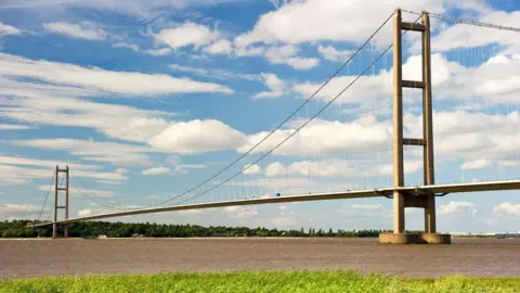
Hessle and Humber Bridge
 Steve Goacher/Getty
The trail starts in Hessle with views of the towering Humber Bridge.
For the first few miles, it follows the Humber estuary, which is a great stretch for spotting ships and wading birds.
Heading northwest, the trail reaches the pretty village of Welton and then winds through Brantingham.
The final stretch features woodland paths and wide views before descending into South Cave.
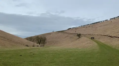
Rural hamlets
The path towards Goodmanham is surrounded by rolling hills, valleys, streams and villages.
It is also home to important archaeological sites, including Iron Age burial mounds linked to the Arras culture.
Goodmanham itself is a charming village, known for its holy wells.
According to the early English historian Bede, the village played a key role in the conversion of the king of Northumbria to Christianity, in the year 627.
The kingdom's high priest is said to have smashed a pagan temple on the site of what is now All Hallows' Church.
East Yorkshire's largest parkland
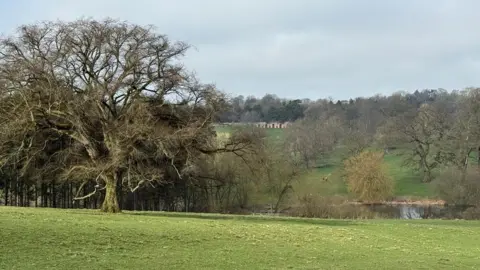
The Wolds Way passes through Londesborough Park, which is often noted for its picturesque landscape.
Approaching the village, there are traces of the old Hall, which once owned by the Duke and Duchess of Devonshire.
There is also a good chance of spotting red kites, who are a common visitor to the area.
Medieval village
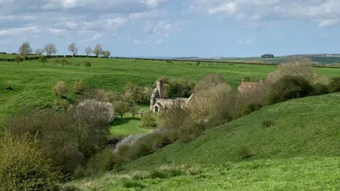
Dry valleys are a special feature of the Wolds, with their calcium-rich soils, which result in a lush carpet of summer wildflowers.
Beyond Thixendale village, the Wolds Way reaches the highest point on the walk at 700ft (213m) before descending into Deepdale, where visitors can discover the deserted village of Wharram Percy.
The settlement was largely abandoned in the 15th Century and only the ruined walls of St Martin's Church remain above ground.
Archaeologists have been crawling over it for years and it is one of the most studied medieval sites in Britain.
Sun, sea and sand
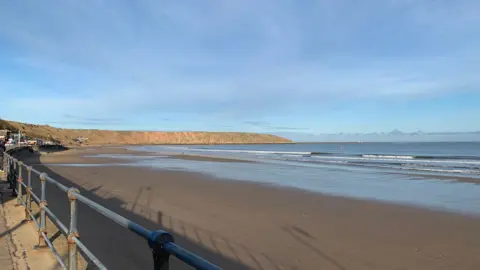
The last section of the Wolds Way finishes on the dramatic headland of Filey Brigg.
Walk down to the beach where you can kick off your boots and paddle in the sea.
Look closely out on the water and you may get the chance to spot seals and harbour porpoises.
Listen to highlights from Hull and East Yorkshire or Lincolnshire on BBC Sounds, watch the latest episode of Look North.
Download the BBC News app from the App Store for iPhone and iPad or Google Play for Android devices